
Habitat Assessments
Habitat Assessments Using Drones

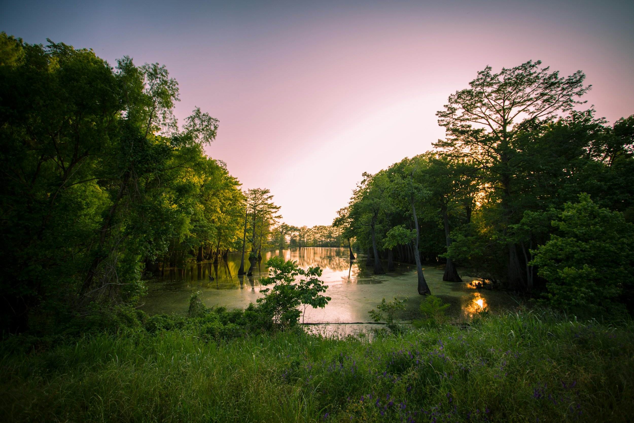
At Gotham Bat Conservancy, we work to protect and preserve bat populations by ensuring they have safe and suitable habitats. Habitat assessments conducted by our Urban Bat Lab are a crucial part of this mission, allowing us to identify and advocate for the protection of areas that are essential for bats, particularly during their active summer months.
Why Use Drones?
Drones offer several advantages for conducting habitat assessments. They can survey large areas quickly, saving our team a lot of time and resources. They can also reach remote and difficult-to-access locations that may be important bat habitats. One of our favorite reasons for using drones is that they minimize human disturbance to sensitive environments and wildlife when used during the off-season.
The collected footage is analyzed by our team to identify features such as roosting sites, foraging areas, and landscape elements that are crucial for bats. This data informs our conservation strategies and helps us prioritize areas for protection.
Off-Season Survey Benefits
Proactive Conservation: Early identification of critical habitats allows us to develop plans to advocate for protective measures in advance of potential harm. Conducting surveys during the off-season, when foliage is less dense, enhances visibility and allows us to identify potential habitats more accurately.
Annual Monitoring: Continuous monitoring helps us track habitat changes and address threats promptly.
Informed Decision-Making: The data we collect supports informed decisions on how we can advocate for conservation policies and actions.


Ground Assessments
Visual Inspections
We conduct thorough visual inspections of potential roosting sites by examining trees, caves, and other natural structures for signs of bat presence, such as bat droppings and staining. Trees with peeling bark, cavities, or dead limbs are also closely inspected as they provide ideal roosting spots. Additionally, in urban areas, we inspect buildings and other man-made structures where bats might roost, particularly on the exterior of structures with fine architectural details.
Habitat Feature Mapping
Mapping habitat features are crucial for understanding the suitability of an area for bats. We catalog tree species and their distribution, identify and map water bodies like ponds and streams, and assess vegetation types. Additionally, we document landscape features such as cliffs, rocky outcrops, and open fields that can affect bat flight patterns and foraging behavior.
Vegetation Surveys
These surveys involve documenting plant species present in a habitat and noting their abundance and distribution. We evaluate the structure of the vegetation which may impact the microhabitats available for bats. Monitoring seasonal changes in vegetation helps us understand its effect on bat activity and habitat use throughout the year.
Foraging Habitat Quality
To ensure bats have adequate food resources, we assess foraging habitat quality by collecting and analyzing insect population samples measuring the diversity and abundance of insect species. Observing bat foraging behavior in different habitats helps us identify areas with rich food resources.